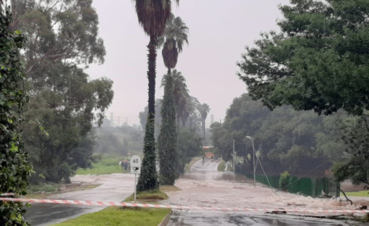
Most of the country can expect rains over the coming days, with the risk of flash flooding in some places. The central and eastern parts of the country have already seen flooding in recent days and weeks due to a lot of rain that has been experienced since the beginning of the summer rainfall season. The ground in many of these places remains saturated and rivers and streams are running full. Under such conditions, a flash flood could be triggered quite easily, and the public is therefore strongly urged to be extra vigilant.
The latest severe weather event will be due to a cut off low (COL) pressure system, developing west of the country, and is expected to intensify from Saturday (10 December 2022) as it moves closer. The system will influence weather patterns over most parts of the country during the next five days, resulting in scattered to widespread showers and thundershowers in places. Severe thunderstorms and heavy rainfall are likely, starting from the Northern Cape, Western Cape, Eastern Cape, and KwaZulu-Natal on Saturday, spreading to the Free State on Sunday, and reaching Free State, North West, Gauteng and Mpumalanga by Monday. Other hazards associated with this system are hail and lightning.