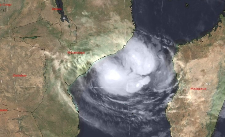
Cyclone Freddy is coming back for a second time and is predicted to hit Quelimane tomorrow (Friday 10 Mar) much harder than it hit Vilankulos two weeks ago (24 Feb). Winds of 140 km/h and gusts up to 170 km/h, and rainfall between 100mm and 200 mm, are expected in Quelimane on Friday. Freddy will move to Tete and Malawi on Saturday.
This pattern of going inland and then returning to the Mozambique channel is uncommon but has occurred, for example Cyclone Delfina, New Year's eve 31 December 2002 and Cyclone Gombe on 12 February 2021.
What is unique for Cyclone Freddy and Cyclone Idai is that both turned around a second time and hit Mozambique again, harder the second time than the first. Idai (below) was just a tropical storm when it hit Angoche on 4 March 2019 and moved in Malawi and then back to the Mozambique Channel on 9 March, hitting Beira on 15 March as the deadliest and costliest cyclone to ever hit Mozambique.
For both Idai and now Freddy, the extra week over the Mozambique channel means the cyclone was sucking up more warm water and energy for the sea, causing stronger winds and more rain.
Two unique cyclones in four years which turn around on land, go back into the Mozambique Channel, and turn around again to come back to hit Mozambique harder, raise questions about the role of the climate emergency. There is no clear answer, but the increasing temperature of the Mozambique Channel must have a role, giving the cyclones extra energy.
Freddy is also now the longest lived cyclone recorded. It reached wind levels high enough to be a cyclone and be named on 6 February, 32 days ago. It started north-west of Australia and travelled west across the Indian Ocean and across Madagascar


